ACM holds two exploration permits for gold: Mboumi and Minkébé, spanning around 1,471 sq km.
Mboumi Project
The Mboumi (Ndjolé) Project is a gold exploration project south of Ndjolé. Although alluvial gold has been exploited, the hard rock source has not yet been identified, despite efforts by multiple companies over the last 20 years. ACM aims to locate the source of alluvial gold.
Mboumi Project development follows a phased exploration approach.
Reconnaissance and target generation are complete, involving historical data reviews, extensive soil sampling, geological mapping, and ground geophysics.
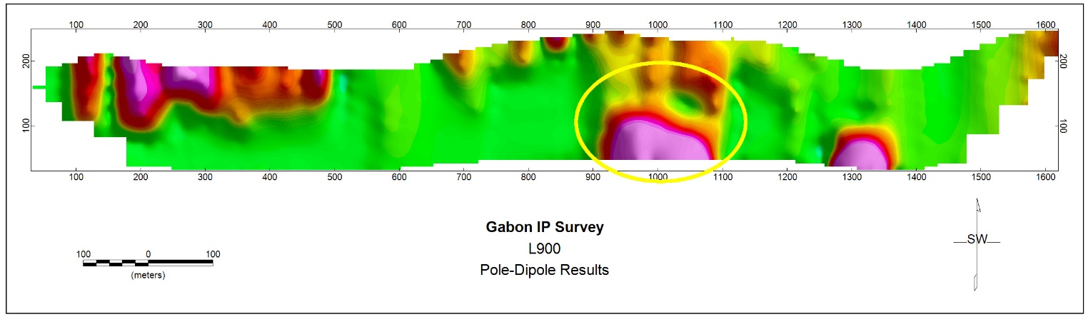
Scout drilling is ongoing, with 31 diamond drill holes (6,200 m) completed to test geophysical targets. Assays from selected intervals are being interpreted, and further sampling of previously unsampled core is ongoing. Additional close-spaced drilling will test spatial continuity.
Subsequent phases are contingent on the results of exploration drilling. The project systematically progresses through stages of investigation, sampling, and drilling to assess the gold potential of the area.
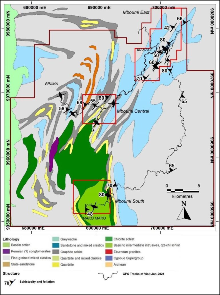
- Targets for soil geochemical sampling are developed based on historical data. A total of 13,118 samples have been collected and analysed for Au and multi-elements at ALS Global.
- Structural and lithological mapping has been completed for 293 traverses (697-line km), covering 106.8 sq km: 2,468 lithological points and 331 structural observation points have been collected. ACM’s staff has been trained by SRK’s senior consultants in mapping.
Minkébé Project
Minkébé Gold Project development is ongoing with a systematic approach.
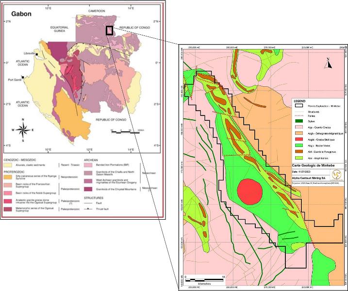
The Minkébé exploration permit surrounds a broadly NW-SE trending ridge consisting of the Group de Belinga “Greenstone Belt,” amphibolite, and banded iron formation (BIF). This ridge is surrounded by a granitic basement of Meso-Archean age.
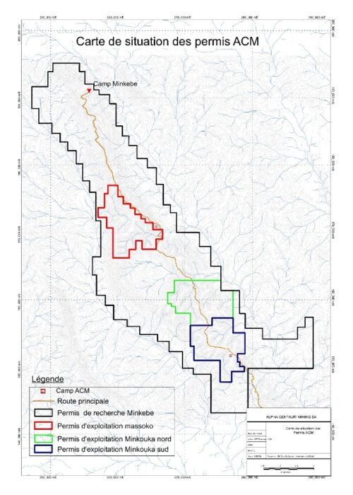
Three occurrences of secondary gold, known from historical artisanal mining — Minkébé, Minkouka, and Massoko — have been recorded.
Minkébé was the largest open-pit operation, closed by the state in 2011.
It is reported that the workers exposed the primary gold source (quartz veins) within the Minkébé pit.
Gold mineralization was thought to be associated with volcano-sedimentary rocks within the amphibolite and greenstone units.
The permit also has potential for iron ore (BIF), as suggested by magnetic data and historical reconnaissance mapping by the BRGM.
The Minkébé permit’s biggest challenge was the absence of any road access.
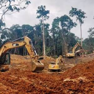
ACM’s road access project to Minkébé was launched to overcome the historical lack of access to the site. ACM undertook the challenge of building approximately 120 km of new roads. This project involved surveyors, road engineers, environmental teams, botanists, operators, and heavy machinery. The road access was completed by August 2024, well within the expected timeframe.
An airborne geophysics survey over the complete 668 sq km was completed by NRG in June 2023 and interpreted by SRK. A total of 7,585 linear km were flown, with data collected at 100-meter spacing.
Geological mapping is ongoing, and over 13 priority zones have been identified post-airborne geophysics.
A stream sediment sampling program was initiated and completed in Q3 2024.
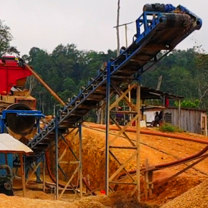
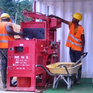
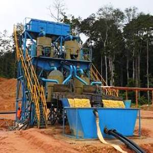
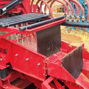
Gold production is ongoing at various sites within the Minkébé permit, with five production lines working continuously to recover secondary alluvial gold.
There are three valid exploitation permits within Minkébé, and going forward, ACM plans to increase its capacity to produce more efficiently.